 |
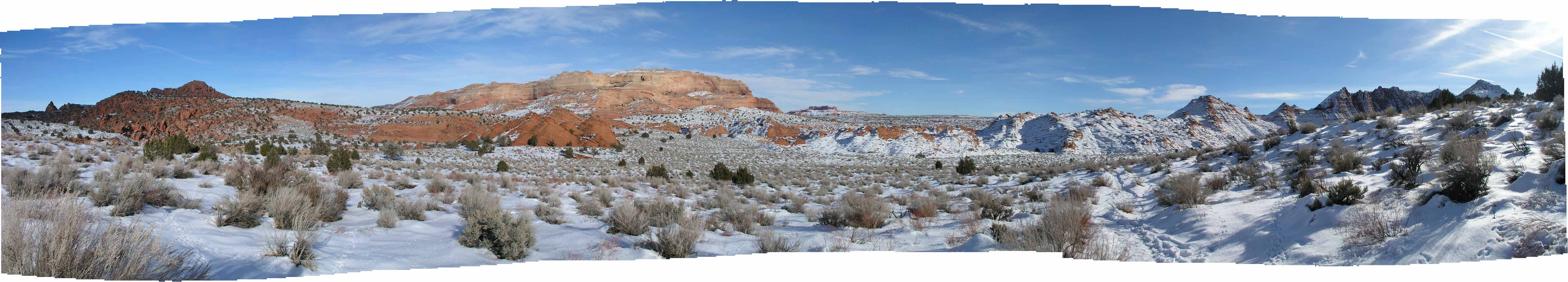
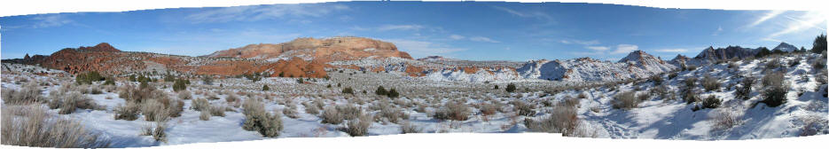
1. This is a view generally east from along the trail to "The Wave" area in North Coyote Buttes
Wilderness Area. The large sandstone formation on the horizon is an edge of the West Clark Bench.
|
 |
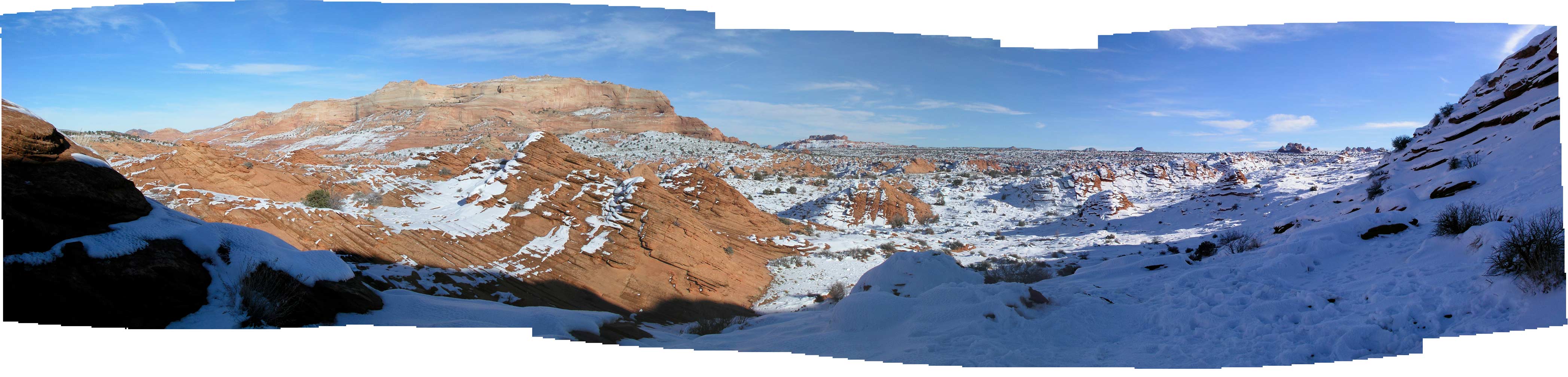
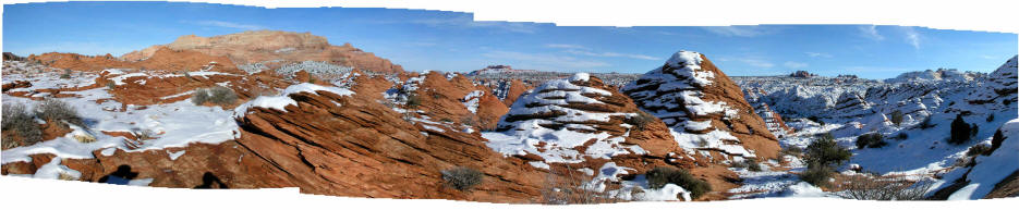
2. Another view farther along on the trail looking generally southeast. You are
walking on either sand or sandstone in this area. We were lucky to
have mostly a groundcover of snow that made it much more easy to hike.
|
 |
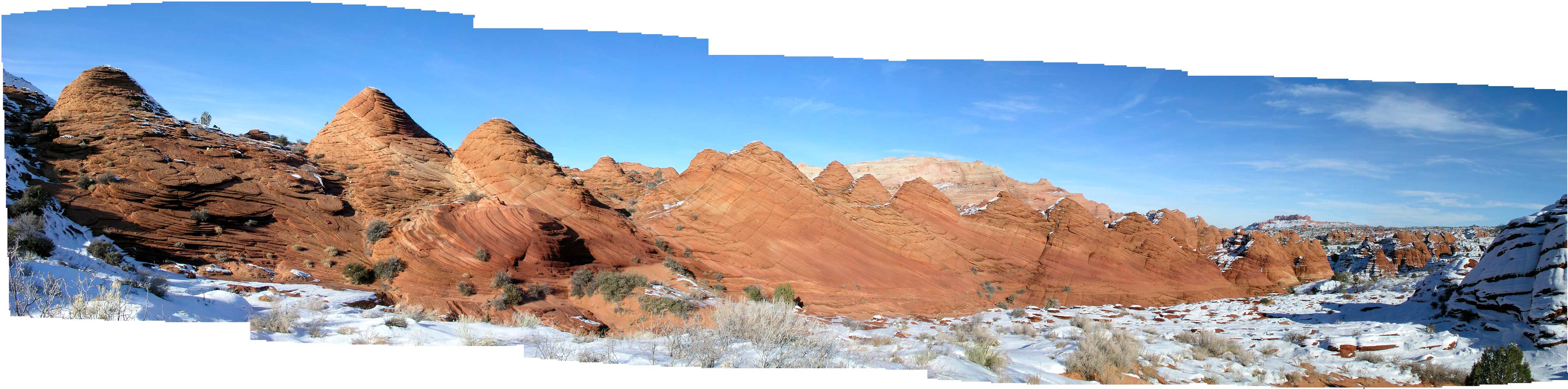
3. Another view northeast and farther into this area. West Clark Bench beyond and on the horizon.
|
 |
4.
Continuing thru this very unique terrain. The hike to "The Wave" is three miles one way and in
the summer on sand would be a long round trip.
|
 |
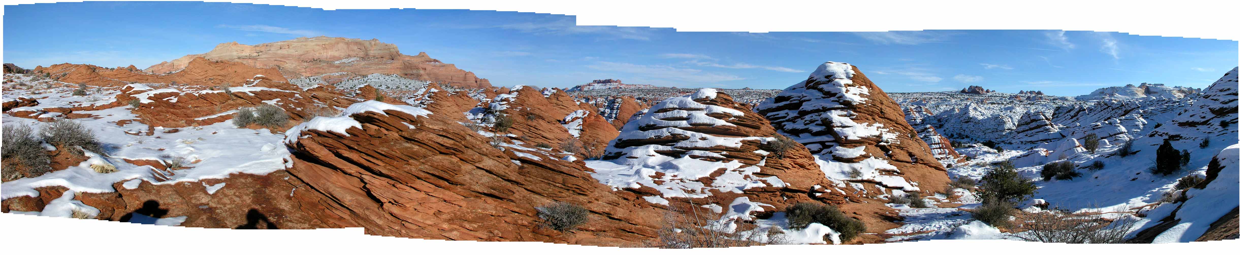
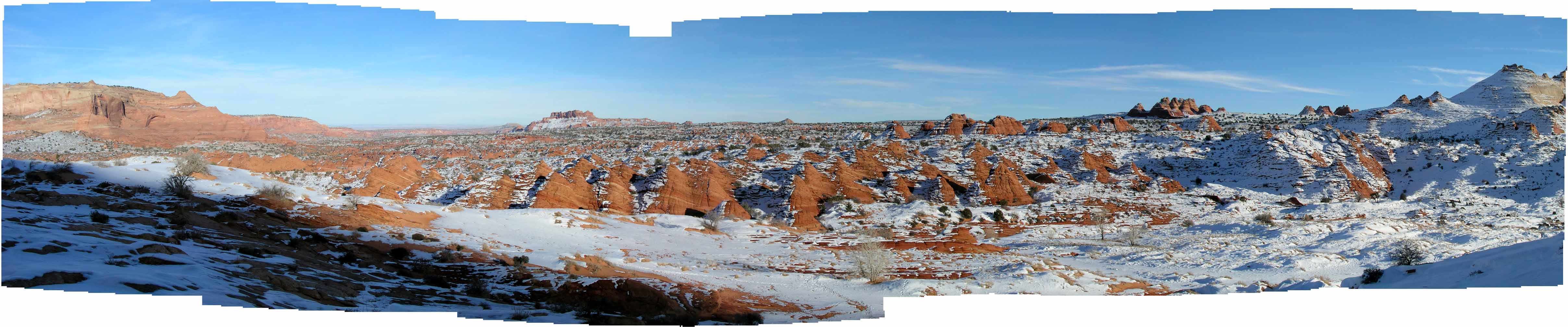
5. This is a very wide view showing the West Clark Bench on the extreme left and a small part of the general "Wave" area
on the right. South Coyote Buttes teepees are visible on the horizon to the right. Only 15 people are allowed in the North Coyote Buttes
Wilderness Area per day. We were lucky in a BLM lottery in Kanab at 8:00 AM the day of the hike and received a permit for two people.
|