 |
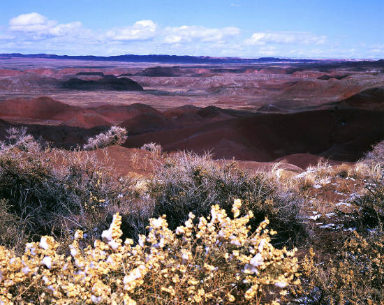
View looking northeast in Petrified Forest National Park from Tiponi Point. Tiponi Point is the first pullout
past the Park's north entry gate. This view is of the eastern areas of "The Painted Desert".
1
|
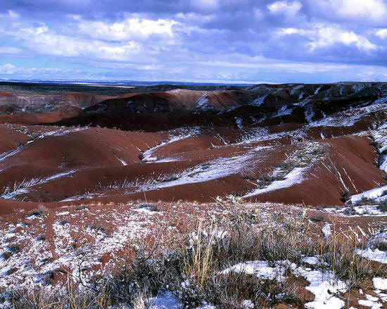 |
Another view looking northeast from Tiponi Point.his image was taken in late December after a brief storm left a dusting of snow on The
Painted Desert. The snow melted within one hour. Petrified Forest National Park is in eastern central Arizona near the
city of Holbrook. It is 116 miles and about a two hour drive from Flagstaff, AZ.
2
|
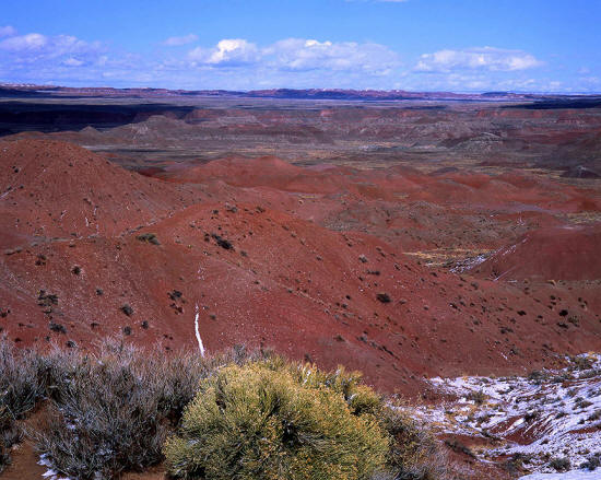 |
View looking northeast from Tawa Point. Tawa Point is the second pullout past the Park's north entry gate.
The Parks North Entry Gate is just north of and visible from Interstate I-40.
3
|
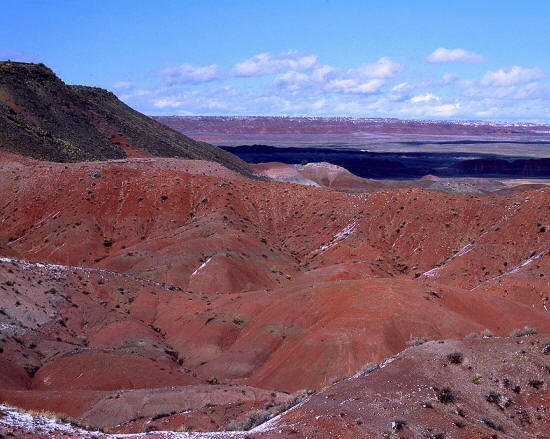 |
Another view looking northeast
from Tawa Point into The Painted Desert. The Painted Desert is a large area of mostly Chinle Formation occuring all the way from Petrifed Forest
National Park in a cresant shape to the eastern end of the Grand Canyon.
4
|
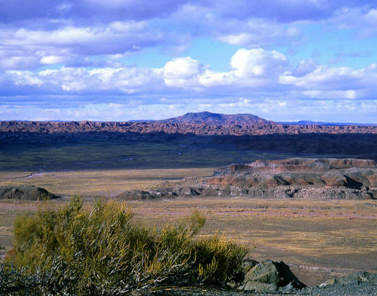 |
Zoomed view looking north from Chinde Point to Pilot Rock. Pilot Rock is six and one half miles from this location.
5
|
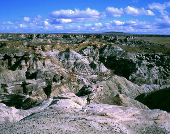 |
A view east toward Saddle Horse Mesa from a pull-out along The Blue Mesa Scenic Road in the central section of
Petrified Forest National Park.
6
|
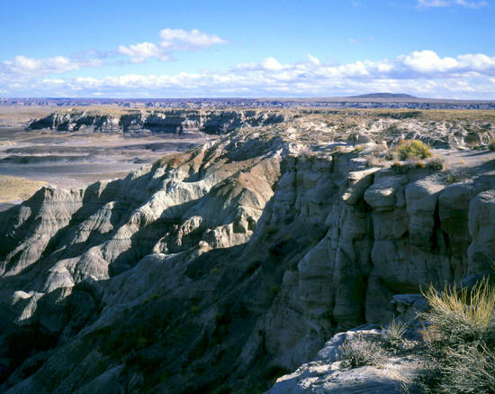 |
Another view generally east from on top of Blue Mesa toward Saddle Horse Mesa from a pull-out along The
Blue Mesa Scenic Road.
7
|
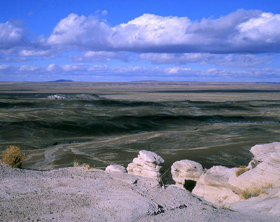 |
A view north over Saddle Horse Draw from the top of Blue Mesa on The Blue Mesa Scenic Road.
8
|
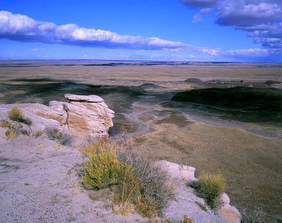 |
A view northeast over Saddle Horse Draw from The Blue Mesa Scenic Road. The drop to the draw
below is just short of 200 feet.
9
|
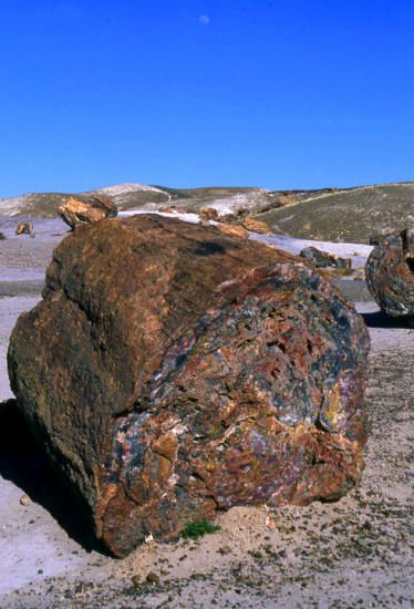 |
A four foot diameter section of petrified tree trunk in the "Crystal Forest" section of Petrified Forest
National Park.
10
|
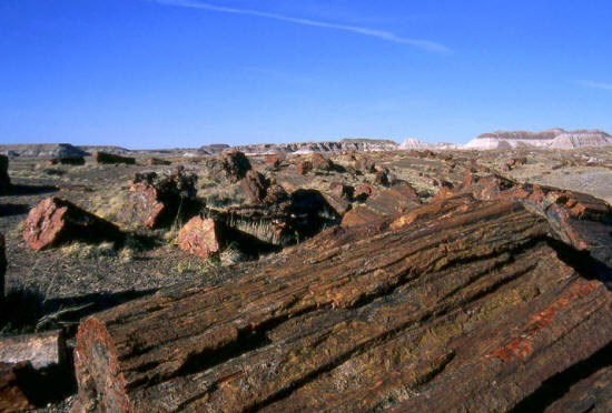 |
Petrified segments of tree trunks in the "Flattops" section of Petrified Forest National Park.
11
|
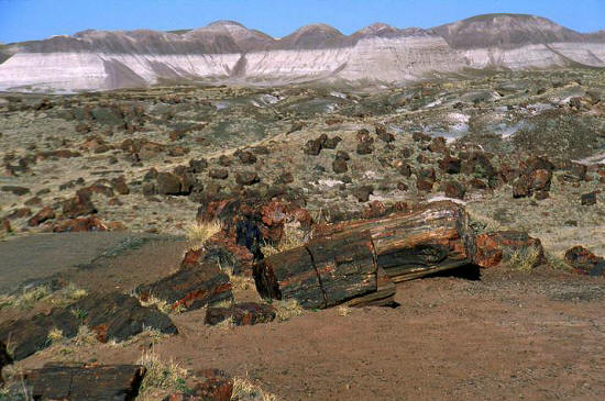 |
Scattered petrified segments of tree trunks in the "Flattops" area.
12
|
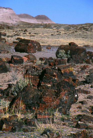 |
Petrified segments of tree trunks in the "Flattops" area. Petrified logs appear iridescent and
therefore very colorful.
13
|
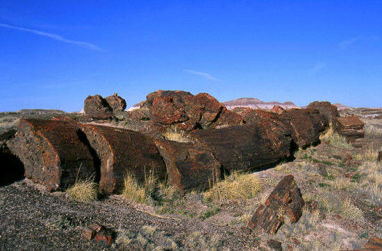 |
Petrified segments of tree trunks in the "Flattops" area.
14
|
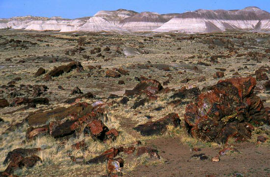 |
Petrified segments of tree trunks in the "Flattops" area.
15
|
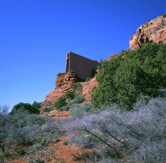 |
View looking northwest to The Chapel of the Holy Cross in Sedona Arizona from Chapel Road. This is one of the finest chapels
on the planet and was designed by the San Francisco architectural firm of Anshen + Adams in the 1950's. Marguerite Brunswig Staude
was the client and provided the initial design concepts and all financial support for the project.
An article on the project
16
|
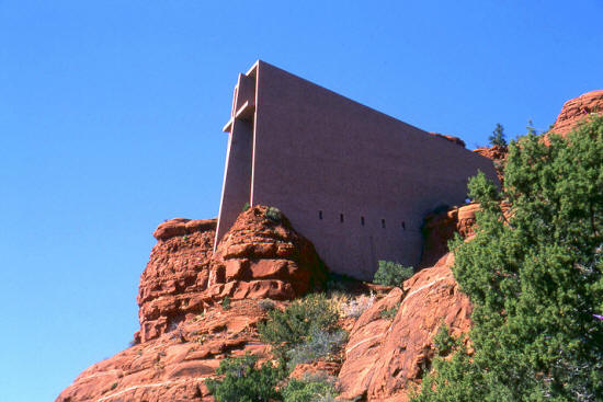 |
Zoomed view looking northwest to The Chapel of the Holy Cross. Anshen + Allen won an honorary design award
in religious architecture from the AIA for the project in 1957. The Chapel also appeared in the September 1958 issue of
Architectural Record magazine.
17
|
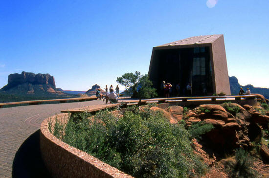 |
View looking south from the beginning of the exterior plaza. The plaza is accessed by a spiral
ramp from the parking lot that circles a sandstone rock formation.
Other views of the Chapel
18
|
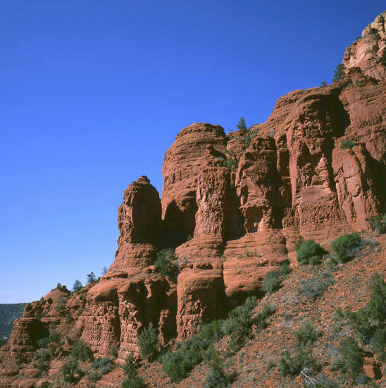 |
View looking northwest from the exterior plaza to the surrounding sandstone cliffs.
19
|
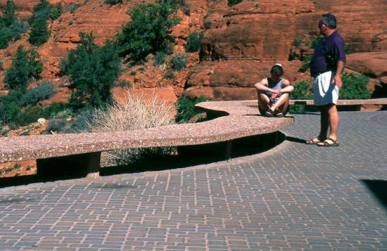 |
Visitors resting on the plaza. This architectural element is a combination guardrail and seating that forms the perimeter of
the exterior plaza. The seating is constructed from poured concrete with exposed aggregate. The plaza is composed of granite pavers.
20
|
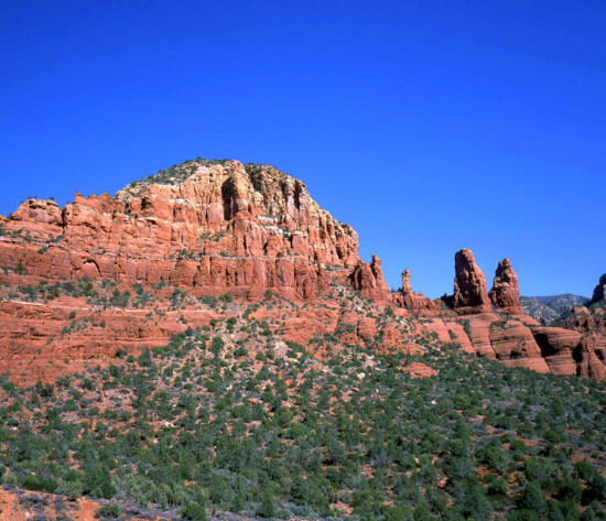 |
View from the plaza looking southeast at the surrounding redrock canyon.
21
|
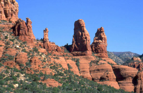 |
Close-up view from the plaza looking southeast to stone needles on the surrounding redrock formations.
22
|
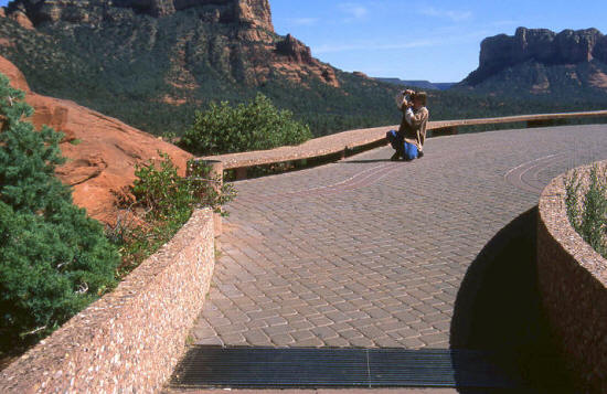 |
View looking southeast onto the plaza from the end of the access ramp.
23
|
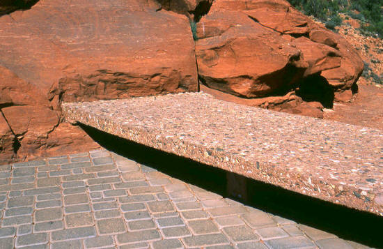 |
Detail of the termination of the seating against the surrounding sandstone.
24
|
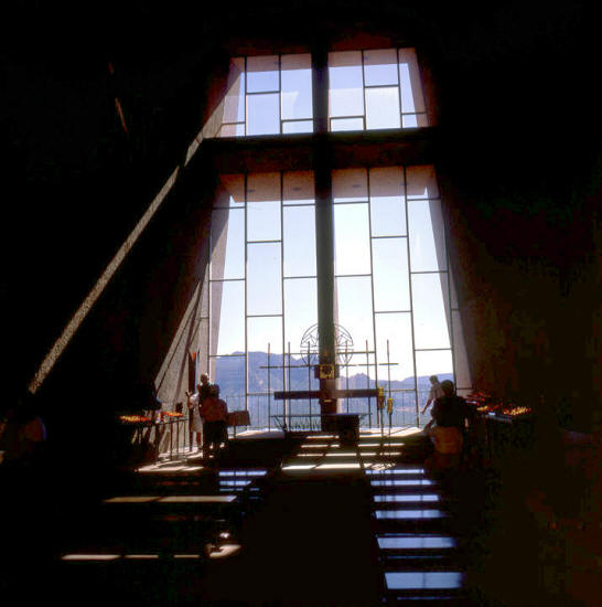 |
View from inside the chapel looking through the south window wall. The monumental cross casts its shadow onto the floors and walls of the chapel.
25
|
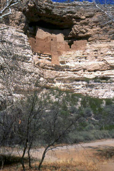 |
This is a view of the primary cliff dwelling at Montezuma National Monument near Sedona, AZ. This dwelling
was built by "The Sinagua" people in approximately 1200 AD. This dwelling is five stories high and contains
20 rooms and is situated approximately 100 feet above the valley floor.
26
|
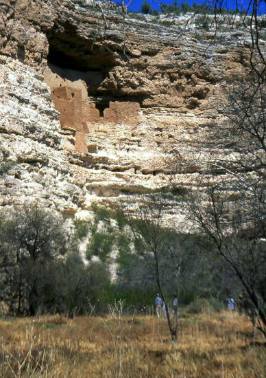 |
A similar view of the primary cliff dwelling nested high in a natural alcove. The visitors near the base of the canyon provide scale.
This canyon is located in a horseshoe bend of Beaver Creek. Beaver Creek is a tributary of the nearby Verde River.
27
|
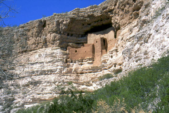 |
View is from the opposite side of the canyon. Access was gained by a series of ladders that led
to tunnels. The tunnels were carved out of the soft rock in passageways that lead to the living quarters higher in the alcove.
28
|
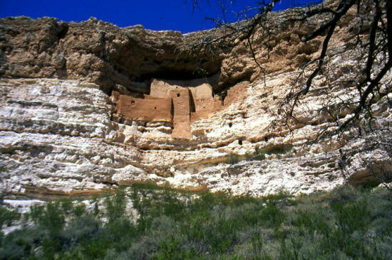 |
A front view of the cliff dwelling from the base of the canyon wall. Another six story dwelling with
45 rooms was located just west of this site at the base of the same cliff.
29
|
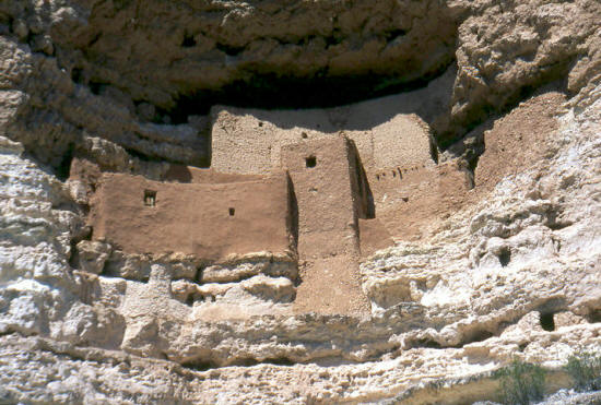 |
Close-up of the cliff dwelling. The access tunnel passageways were built with windows
to allow light. A few of these openings are visible in the lower right
corner of this image. The National Park Service has coated portions of
this cliff dwelling with a light weight concrete in order to prevent
weathering that would cause the structure to collapse into the canyon below.
30
|
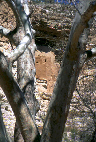 |
A view of the cliff dwelling through the limbs of a sycamore tree in the surrounding canyon amphitheatre.
31
|


