 |
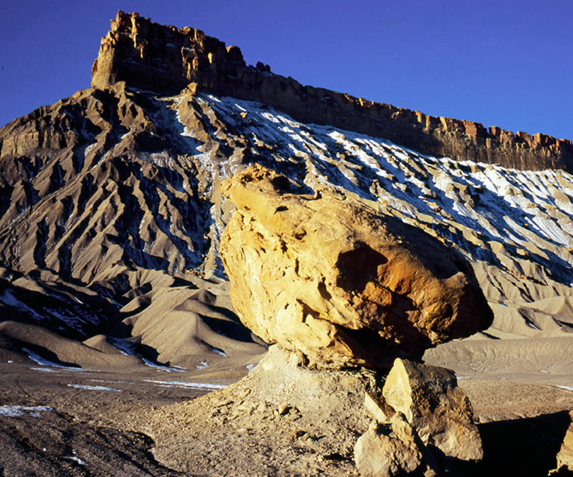
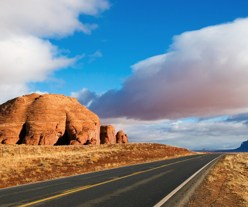
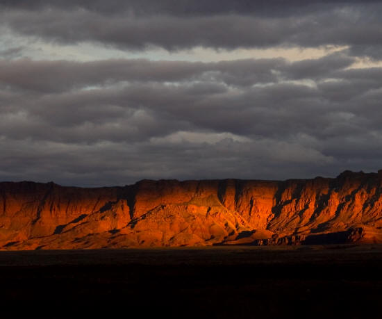
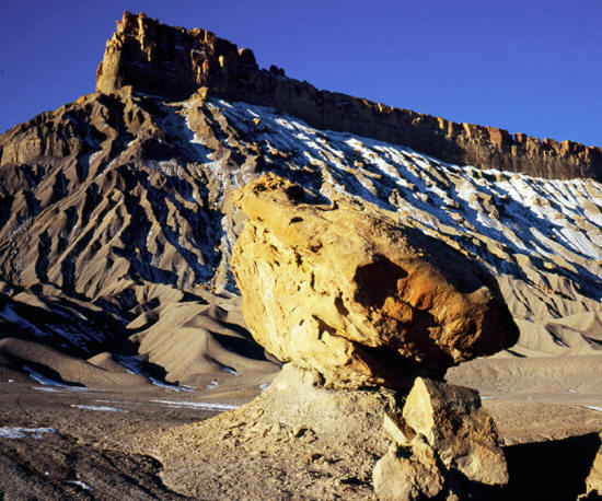
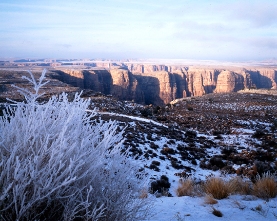
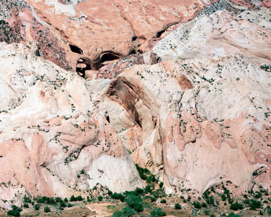
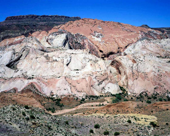
Considered 2013
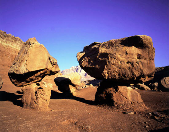
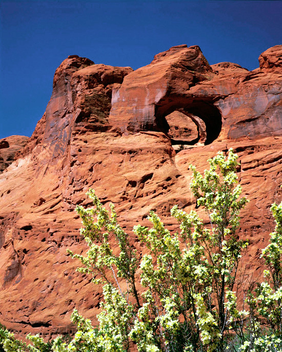
Paria Plateau,
Arizona.
|
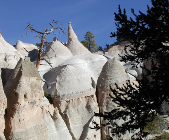 |
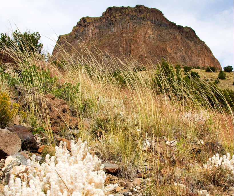
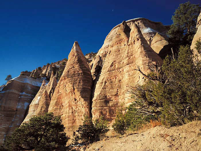
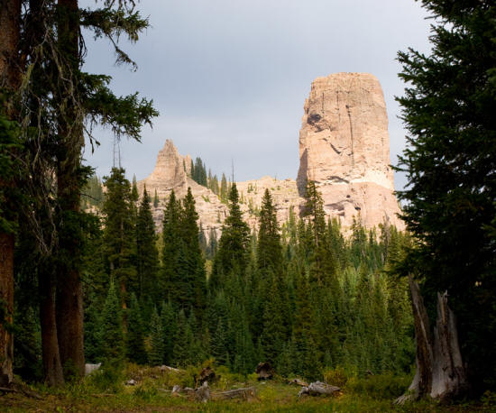
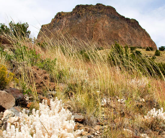
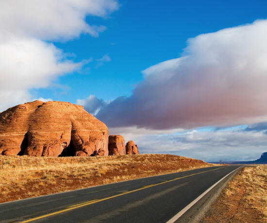
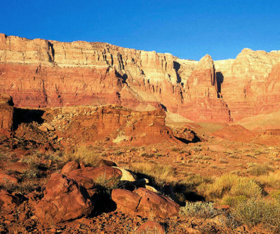
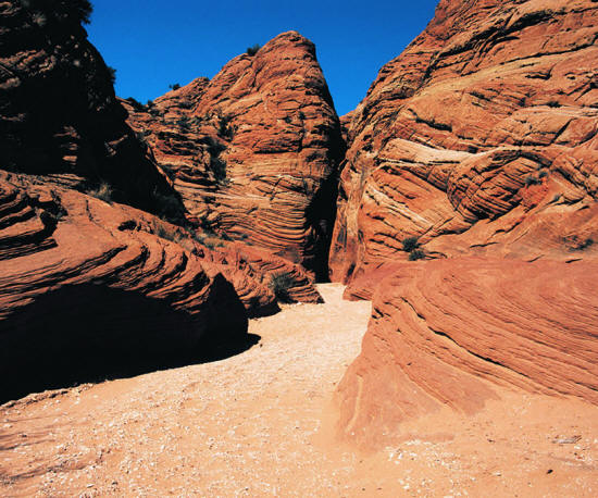
Considered 2013
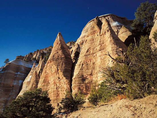
Tent Rocks National Monument.
New Mexico.
|
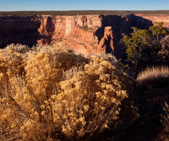 |
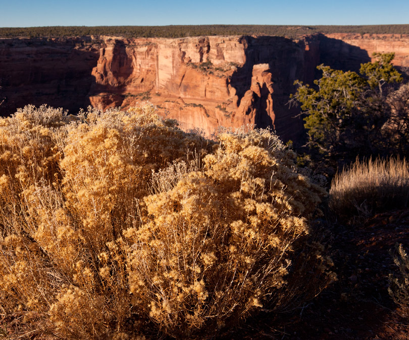
Considered 2013
Spider Rock, Canyon de Chelly National Monument.
Arizona.
|
 |
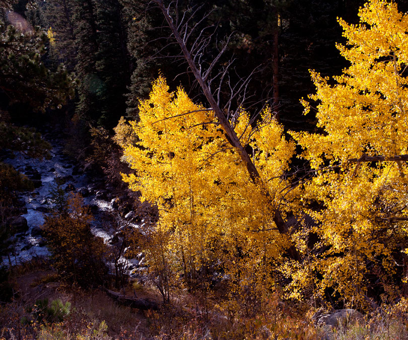
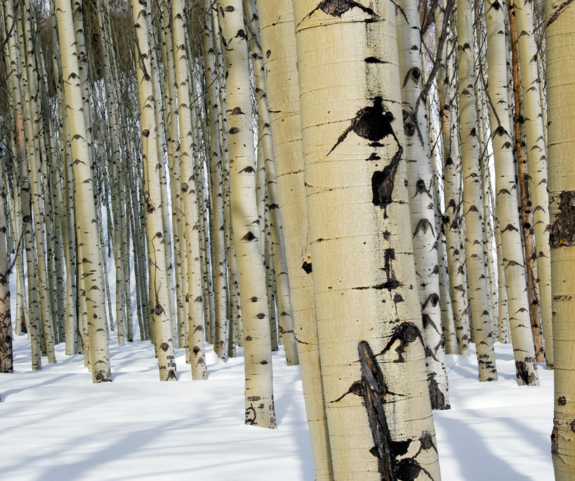
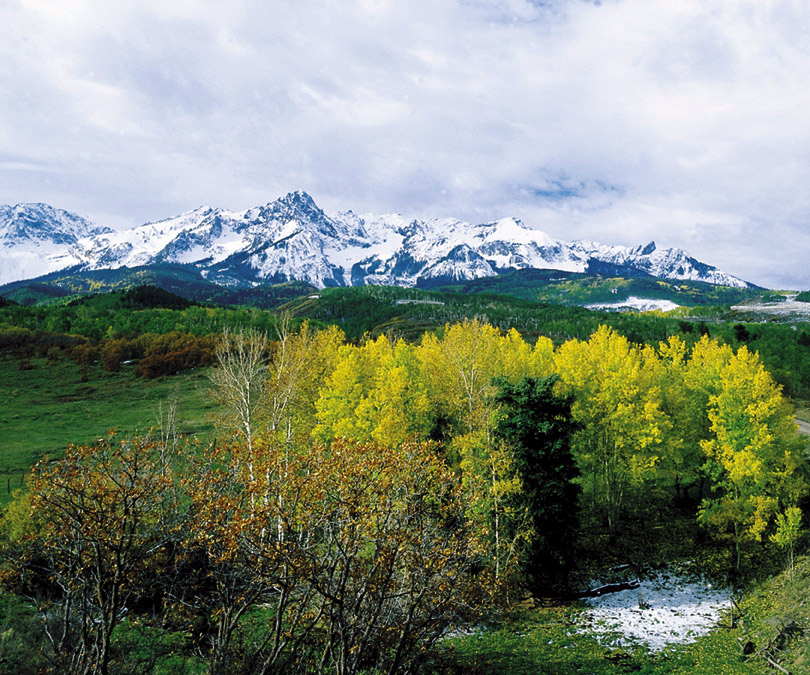
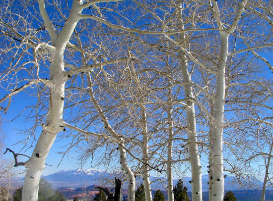
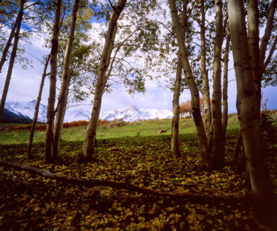
Considered 2013
Fall Aspen, Rocky Mountain National Park.
Colorado.
|
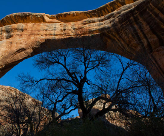 |
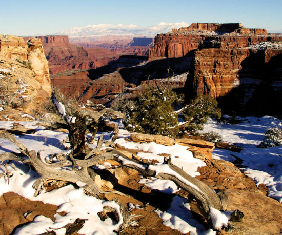
Considered 2013
Sipapu Bridge, Natural Bridges National Monument.
Utah.
|
 |
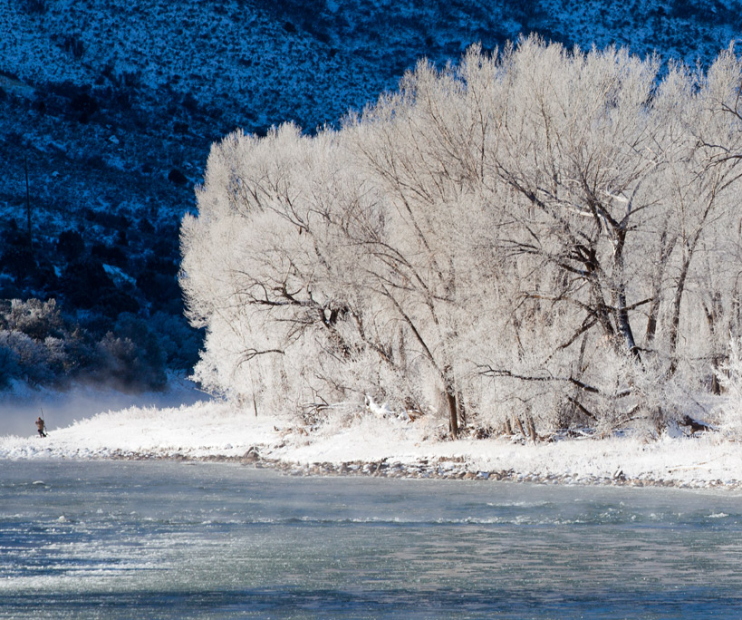
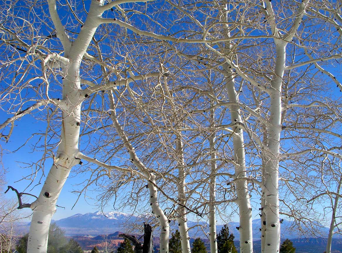
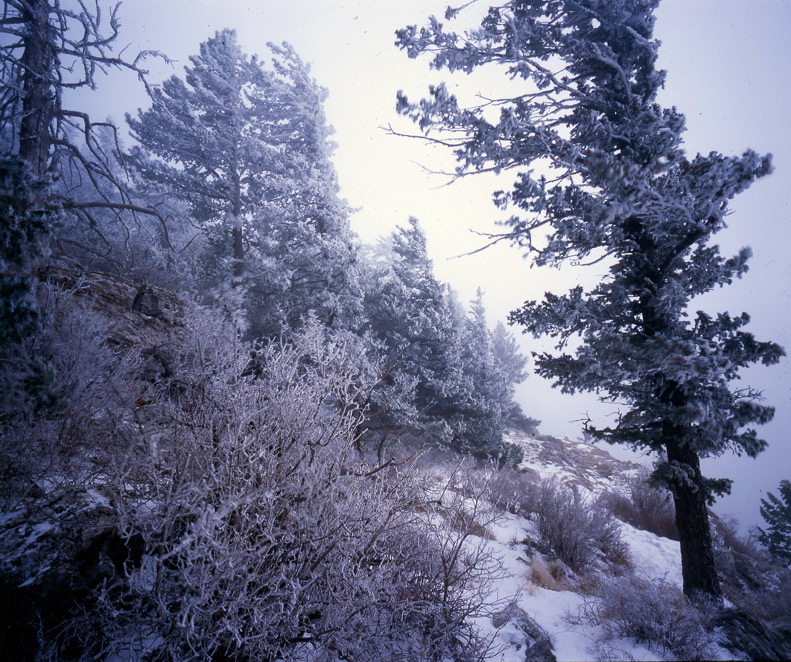
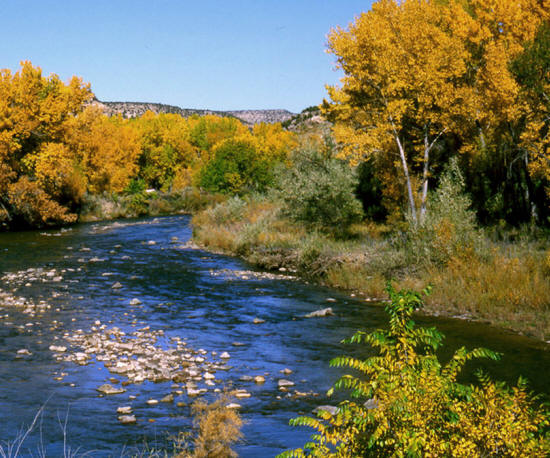
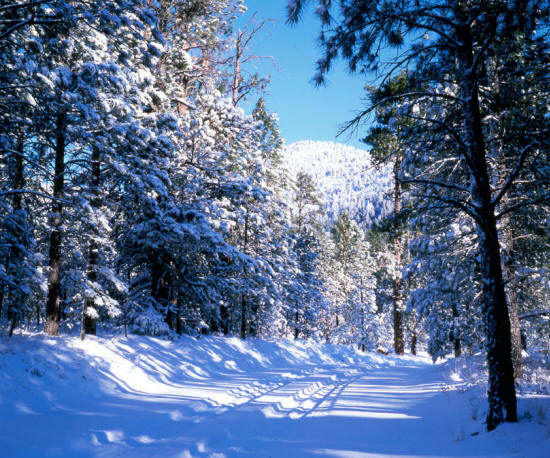
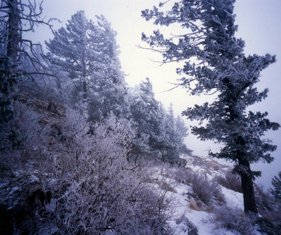
Considered 2013
Hoarfrost on cottonwood trees along The Colorado River.
Colorado.
|
 |
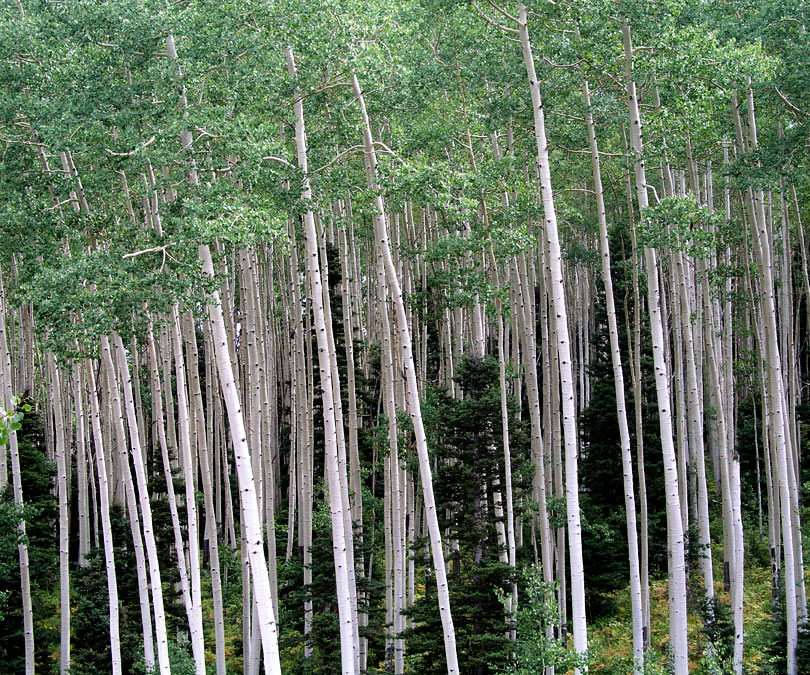
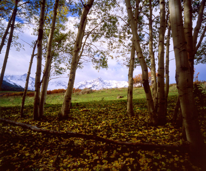
Considered 2013
Aspen, from along Owl Pass Road.
Colorado.
|
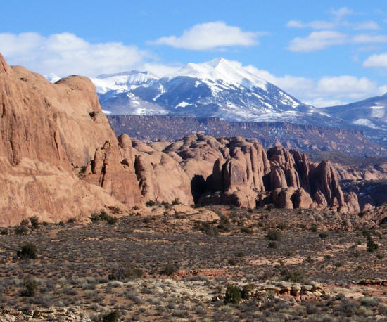 |
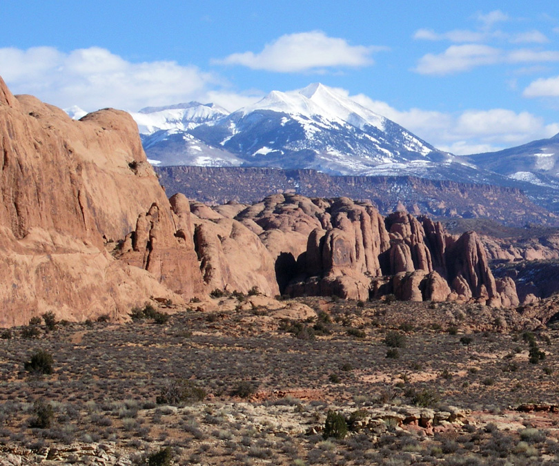
Considered 2012
La Sal Mountains near Moab.
Utah.
|
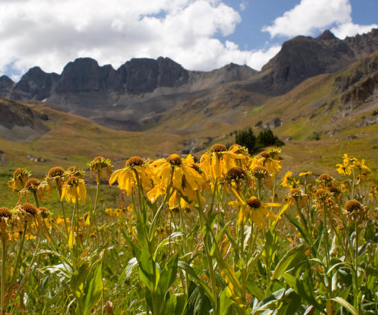 |
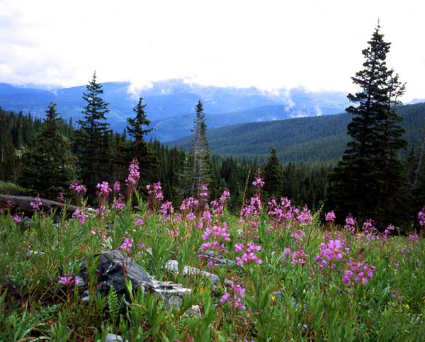
Considered 2012
Wildflowers in American Basin San Juan Mountains.
Colorado.
|
 |
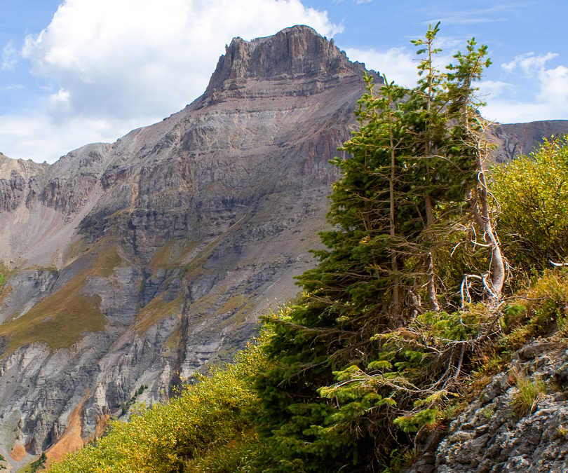
Considered 2012
Potosi Peak from the Govenor Basin Forest Service access road.
Colorado.
|
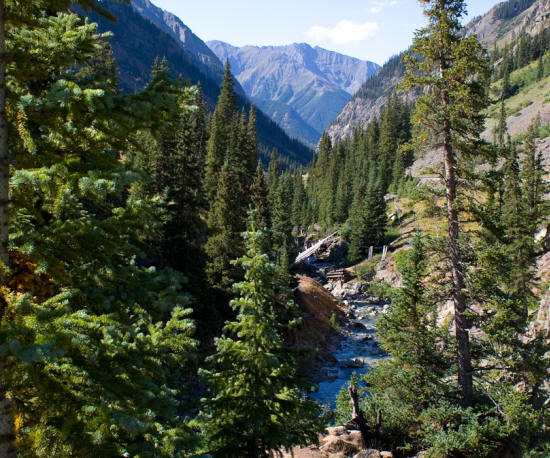 |
Considered 2012
Animas River headwaters.
Colorado.
|
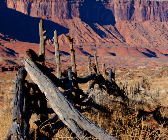 |
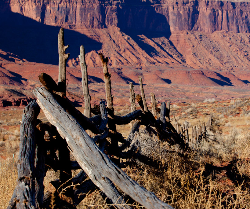
Considered 2012
Wood Fence along Scenic Highway 128.
Utah.
|
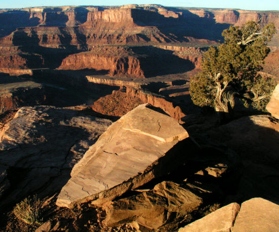 |
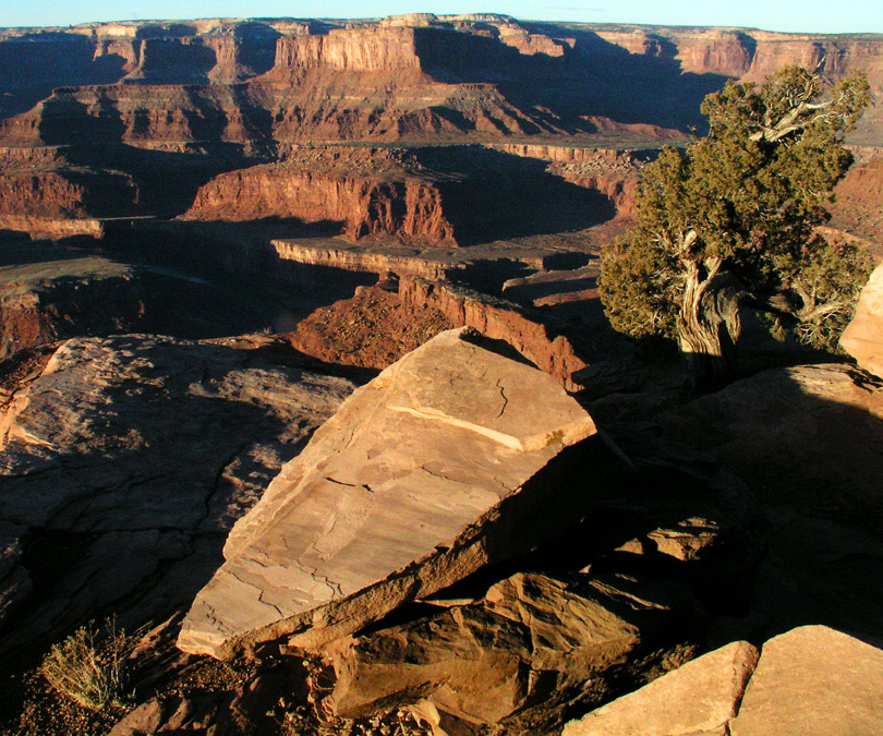
Considered 2012
View from overlook at Dead Horse State Park.
Utah.
|
 |
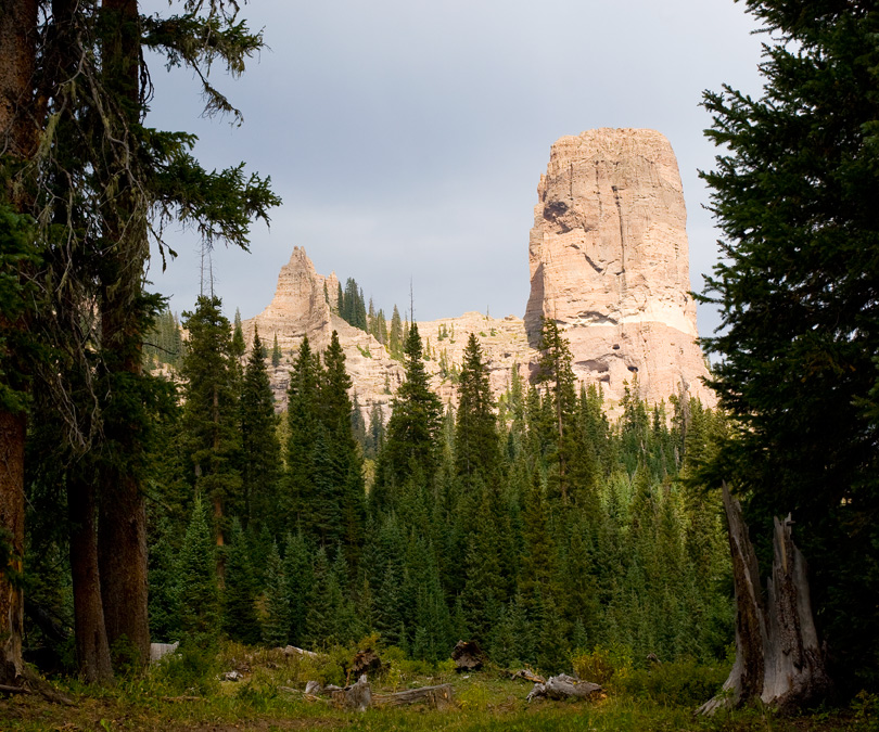
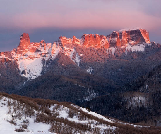
Considered 2012
Courthouse Tower on Cimarron Ridge.
Colorado.
|
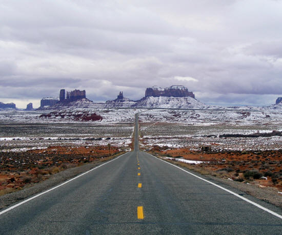 |
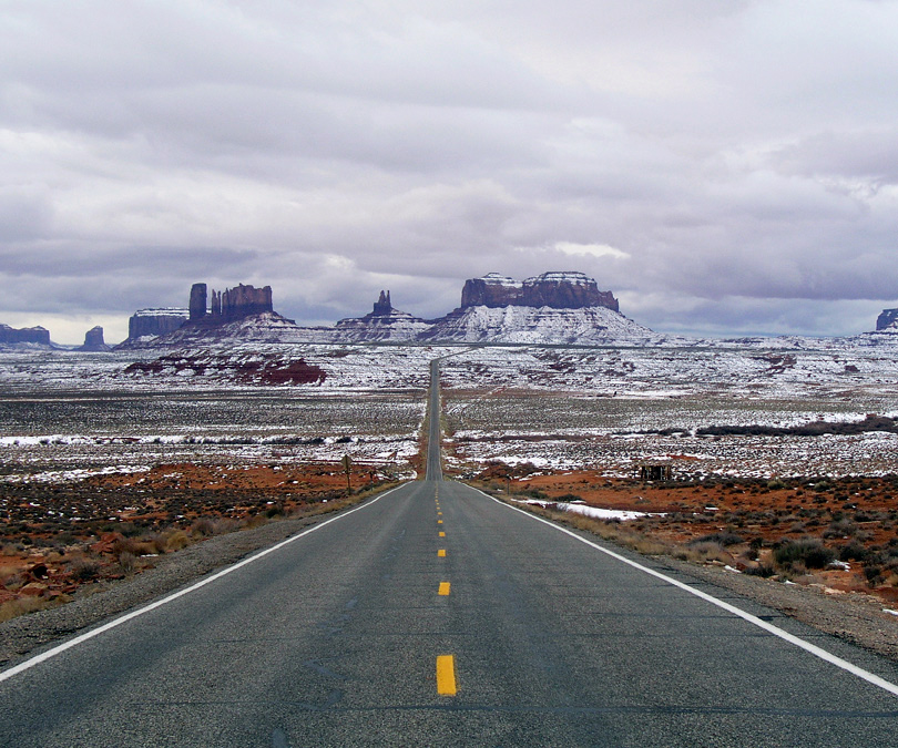
Considered 2011
Monument Valley in winter from Highway 163.
Utah.
|
 |
Considered 2011
Green River Canyon from the Green River Overlook Canyonlands National Park.
Utah.
|
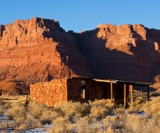 |
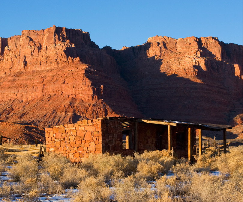
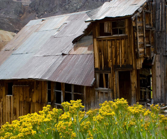
Considered 2011
Abandoned ranch house at Jacob's Pool Vermillion Cliffs National Monument.
Arizona.
|
 |
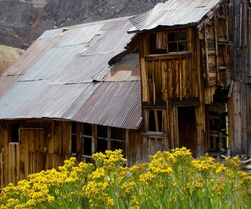
Considered 2011
Bunkhouse ruins in Governor Basin San Juan Mountains.
Colorado.
|
 |
Considered 2011
Climbing the trail at the base of Cabezon Peak.
New Mexico.
|
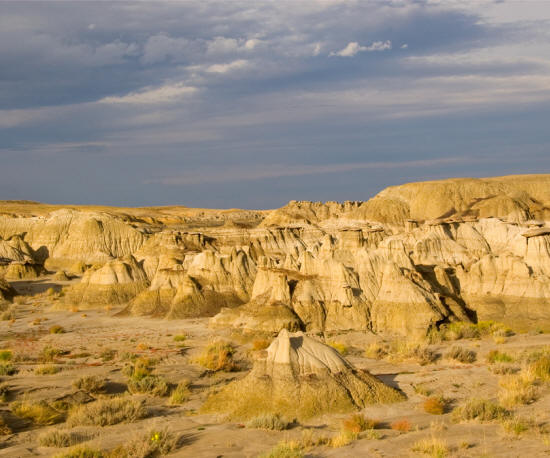 |
Considered 2011
Sandstone caprock and Shale Formation in Ahe shi sle pah Wilderness.
New Mexico.
|
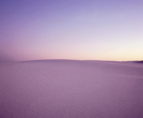 |
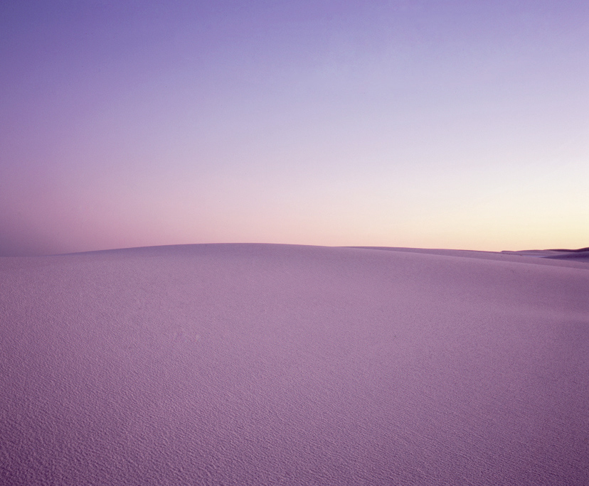
Considered 2010
Sunset at White Sands National Monument.
New Mexico.
|
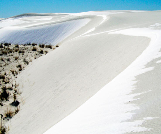 |
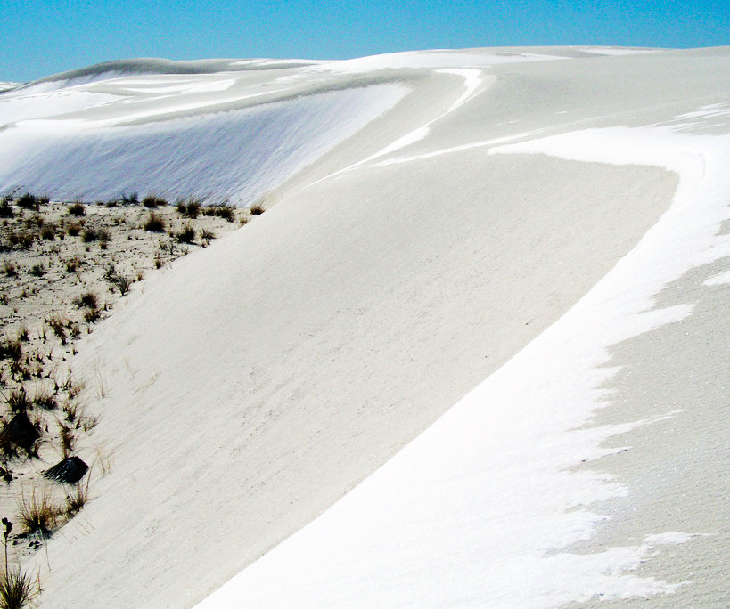
Considered 2010
Snow on dunes at White Sands National Monument.
New Mexico.
|
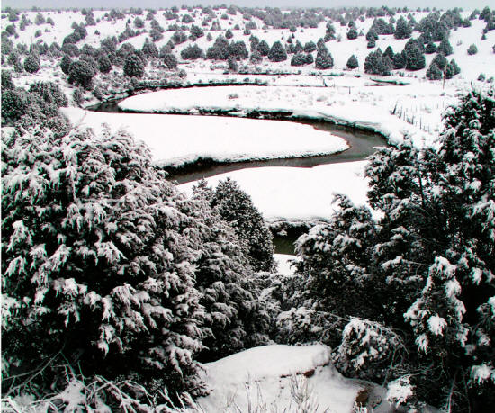 |
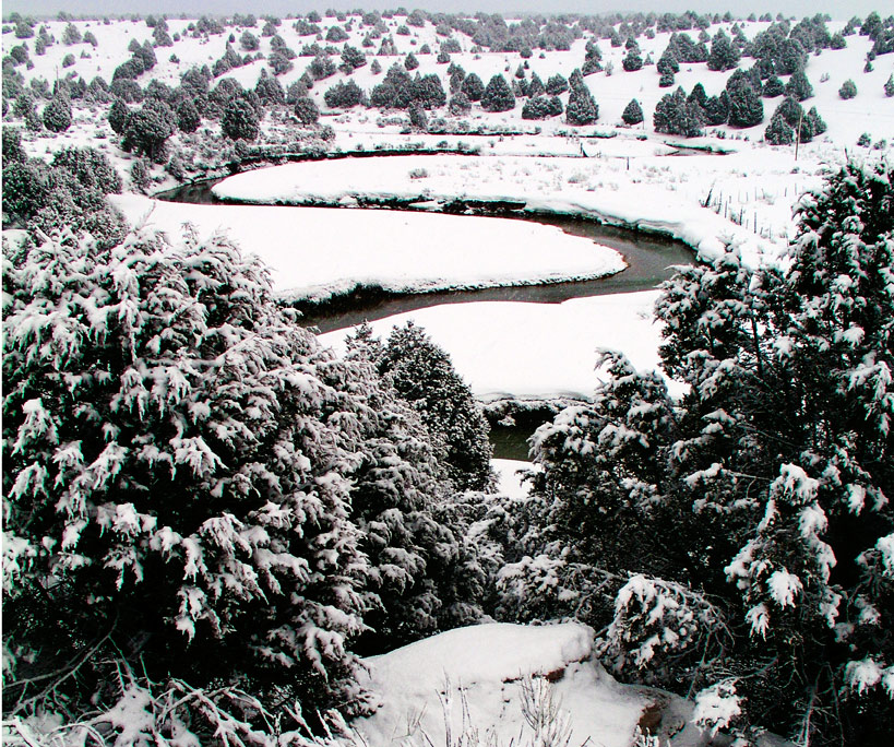
Considered 2010
Siever River meander after heavy snowfall.
Utah.
|
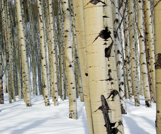 |
Considered 2010
Aspen in winter at McClure Pass.
Colorado.
|
 |
Considered 2010
Sunset on the Echo Cliffs from Cliff Dwellers Lodge.
Arizona.
|
 |
Considered 2010
Early morning light on Factory Butte.
Utah.
|
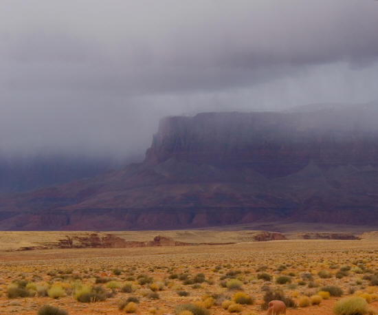 |
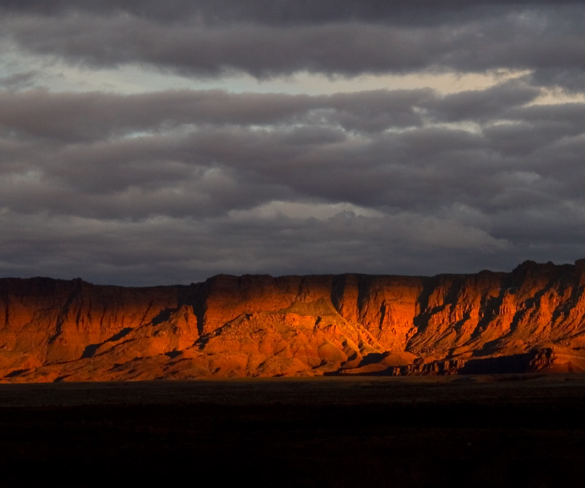
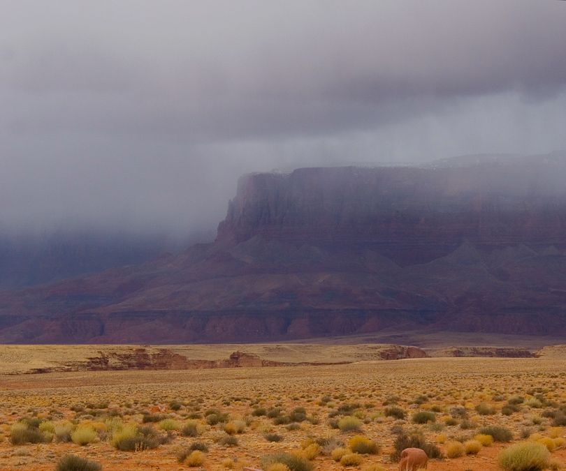
Considered 2010
Echo Cliffs in light rain.
Arizona.
|
 |
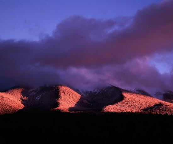
Considered 2010
Cimarron Ridge winter at sunset.
Colorado.
|
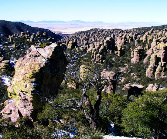 |
Considered 2010
View from Massai Point in Chiricahua National Monument.
Arizona.
|
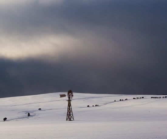 |
Considered 2010
Buffalo and windmill in winter from the Mt Carmel Road near Zion National Park.
Utah.
|
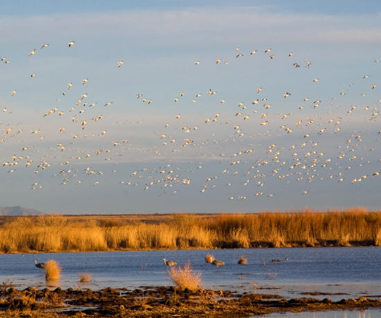 |
Considered 2010
Bosque del Apache, White Geese and Sandhill Cranes near sunset.
New Mexico.
|
 |
Considered 2009
Highway 163 approaching Monument Valley from Keyanta.
Arizona.
|
 |
Considered 2009
View to Monument Basin from Grandview Point Canyonlands National Park.
Utah.
|
 |
Considered 2009
View southwest from Kismet Peak to Mears Peak San Juan Mountains.
Colorado.
|
 |
Considered 2008
View to the San Miguel River in fall from near Naturita.
Colorado.
|
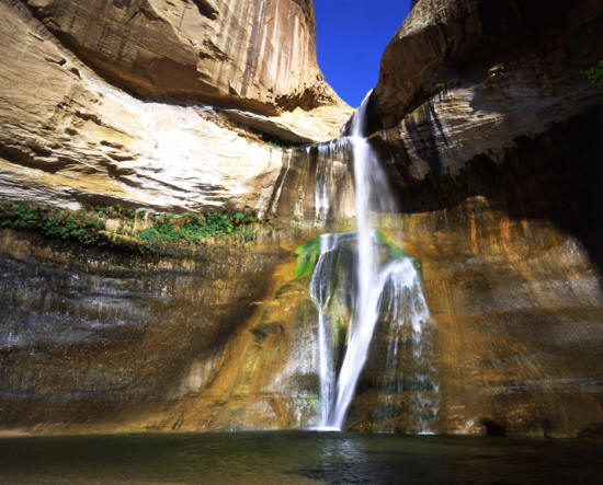 |
Considered 2008
Lower Calf Creek Falls and plunge pool.
Utah.
|
 |
Considered 2008
Aspen on Boulder Mountain in winter.
Utah.
|
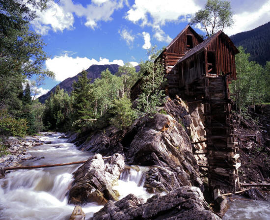 |
Considered 2007
Crystal Mill on the Crystal River.
Colorado.
|
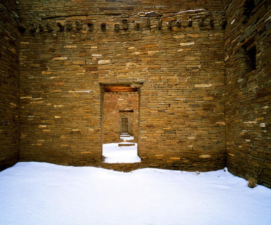 |
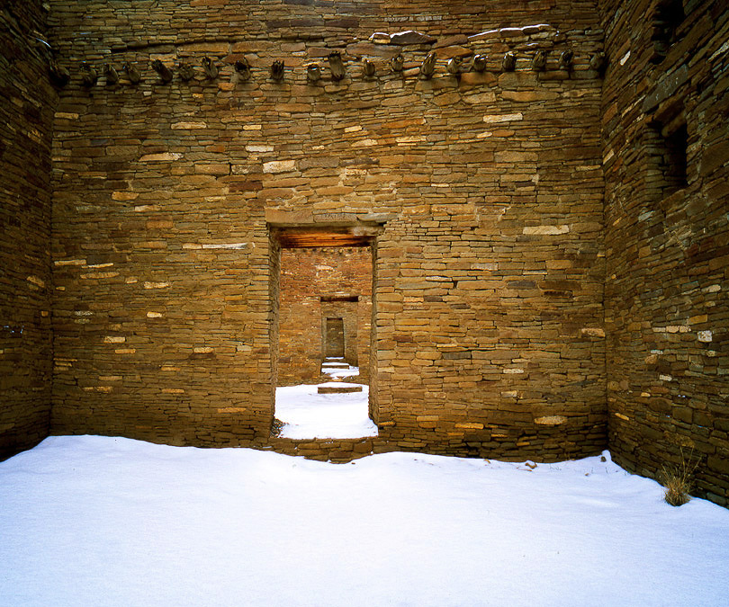
Considered 2007
View through doors in Pueblo Bonito at Chaco Canyon National Historic Park.
New Mexico.
|
 |
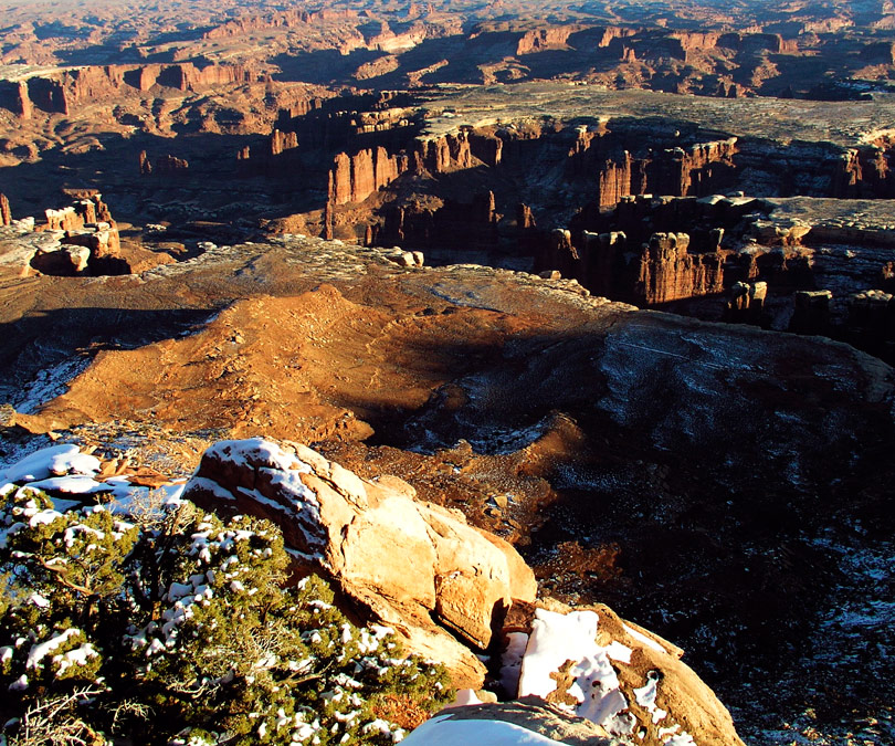
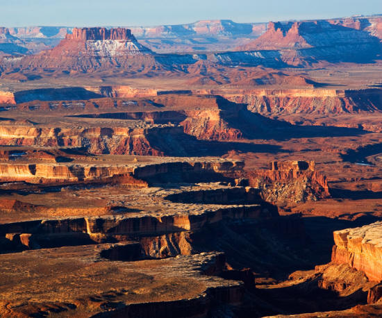
Considered 2007
View into Colorado River canyon near the Schaefer Trail Overlook Canyonlands National Park.
Utah.
|
 |
Considered 2006
View from along Highway 64 to Little Colorado River Gorge in winter.
Arizona.
|
 |
Considered 2006
Mount Hayden and Aspen in fall color - Colorado.
|
 |
Considered 2006
View to Mount Hayden through Aspen in fall color.
Colorado.
|
 |
Considered 2006
Wildflowers along the trail to Mohawk Lake.
Colorado.
|
 |
Considered 2005
Vermillion Cliffs at sunrise - Vermillion Cliffs National Monument.
Arizona.
|
 |
Considered 2005
Shultz Peak from Forest Service Road in winter.
Arizona.
|
 |
Considered 2005
Sandia Crest during winter storm.
New Mexico.
|
 |
Considered 2005
San Fransico Peaks at sunset.
Arizona.
|
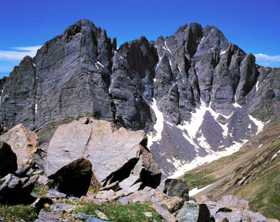 |
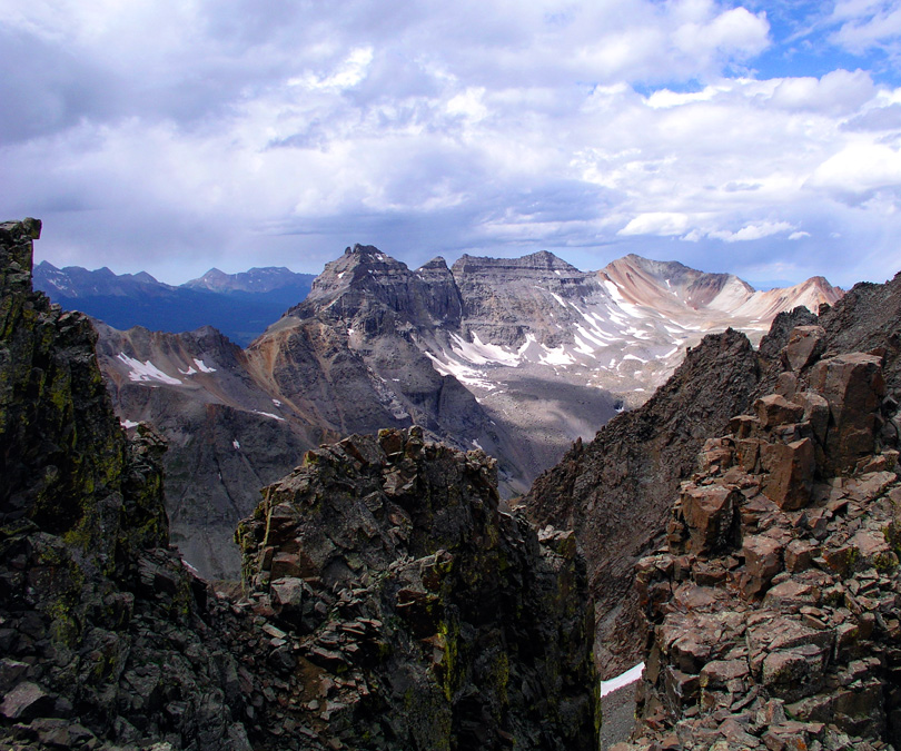
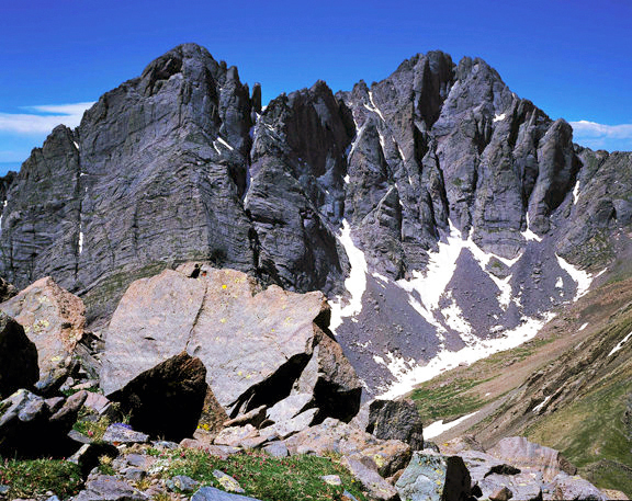
Considered 2005
Creston Needle & Crestone Peak from Humbolt Peak.
Colorado.
|
 |
Considered 2005
Sandstone hoodoos at Cliff Dwellers.
Arizona.
|
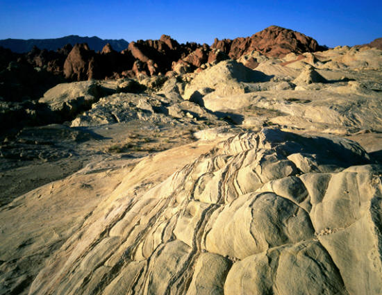 |
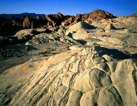
Considered 2004
Valley of Fire State Park.
Nevada.
|
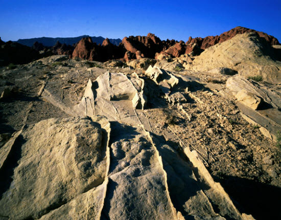 |
Considered 2004
Valley of Fire State Park.
Nevada.
|
 |
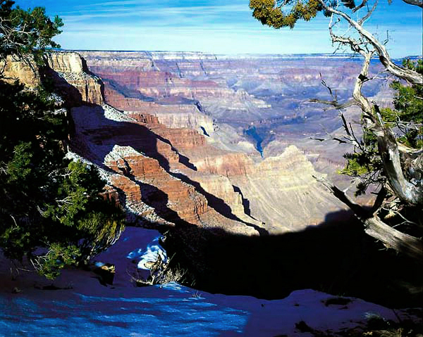
Considered 2004
The Abyss from the South Rim in Grand Canyon National Park.
Arizona.
|
 |
Considered 2003
Trail to Wire Pass and Buckskin Gulch.
Utah.
|
 |
Considered 2003
Arch in Upper Muley Twist Canyon - Capitol Reef National Park.
Utah.
|
 |
Considered 2003
Morning light on Tent Rocks National Monument.
New Mexico.
|
 |
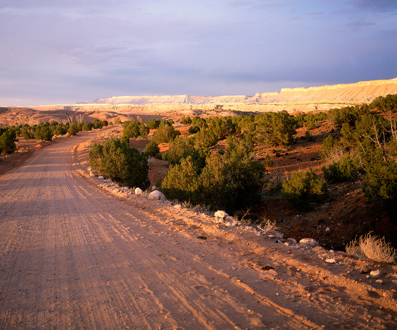
Considered 2002
View north from along the Notum-Bullfrog Road at sunset.
Utah.
|
 |
Considered 2002
Landscape along Burr Trail in Grand Staircase Escalante National Monument near Boulder.
Utah.
|
 |
Considered 2002
Brimhall Bridge as seen from Hall's Overlook in Capitol Reef National Park.
Utah.
|
 |
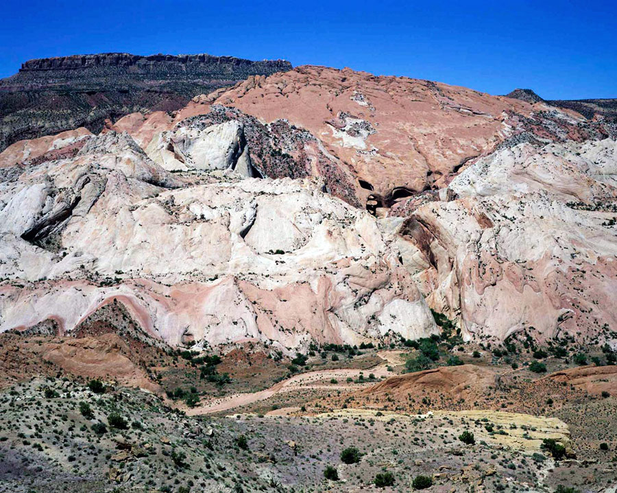
Considered 2002
Capitol Reef as seen from Hall's Overlook in Capitol Reef National Park.
Utah.
|